 Cruise to St Lucia
The Pitons, Saint Lucia
Every Caribbean island has a beach; Saint Lucia has a silhouette. The Pitons - St Lucia's twin volcanic plugs rising 771 and 743 metres straight from the sea on the south-west coast - are the reason postcards sell, the reason boats hug the shoreline, and the core of a UNESCO World Heritage Site inscribed in 2004. This guide covers what the peaks are, where the classic views come from, what climbing them involves, and how a cruise port day actually meets them. Every stop named here is priced in the St Lucia shore excursions compared on this site.
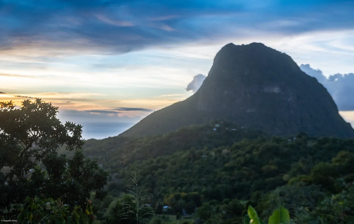
The classic silhouette: Petit Piton (743 m) and, beyond it, Gros Piton (771 m) rising straight from the sea. Photo: xiquinhosilva, Wikimedia Commons, CC BY 4.0.
Quick answer Two volcanic plugs, one UNESCO inscription, and three ways to put them in your day
The Pitons are two eroded volcanic plugs - Gros Piton at 771 m and Petit Piton at 743 m - rising directly from the sea on Saint Lucia's south-west coast near Soufriere. They anchor the Pitons Management Area, a UNESCO World Heritage Site since 2004, inscribed for the pairing of dramatic landform and living reef (coral covers close to 60% of the bay's marine area). From a cruise port day you meet them three ways: from the water, the classic angle every catamaran and speedboat tour sails; from land, at Sugar Beach between the peaks or the viewpoints above Soufriere; and on foot, climbing Gros Piton's official trail (US$50, guide mandatory, four hours) - Petit Piton has no public trail. The peaks even own the island's beer: Piton lager, brewed here and poured in every port-side bar.
Key takeaways
- Want the peaks in your swim photo? The catamaran day sail and private speedboat listings both round the bay
- Climber? The Gros Piton hike guide has the fee, the start-time strategy and the port-day arithmetic
- The views without the climb: the viewpoint table ranks the angles by port-day cost
What the Pitons Are
The Pitons are the remnants of ancient volcanic vents - domes of solidified magma left standing after the softer rock around them eroded away, which is why they read as ideal cones rising from the water rather than peaks on a ridge. Gros Piton, the broader of the two, stands 771 metres (2,619 ft) above the sea about 3 km south-west of Soufriere town. Petit Piton, the sharper spire in the photographs, rises 743 metres (2,438 ft) directly from the bay's edge, close enough to town that its shadow crosses the waterfront at dusk.
The pairing is what makes them globally notable: two steep-sided plugs of different ages rising side by side from the same bay, with the caldera of the system that produced them - the ground that holds the Sulphur Springs drive-in volcano - sitting in the fold between them and the town. The same volcanic plumbing that built the peaks still heats the mud baths seven miles up the road; the Pitons are not scenery near a volcano, they are the volcano.
The waters around them carry the other half of the fame: the bay's reef system, sheltered by the peaks' mass, holds coral across close to 60% of the Pitons' marine area, with sponges, reef fish and visiting turtles - the reason every boat tour in the comparison includes a snorkel stop in these waters.
The UNESCO Inscription, in One Paragraph
In 2004 UNESCO inscribed the Pitons Management Area - 2,909 hectares of peaks, bay, reef and forest - as a World Heritage Site, citing its outstanding natural beauty and its role as the type example of the Antilles' volcanic formation story. The inscription protects more than the two cones: the marine platforms, the coral gardens of the bay, the dry forest on the peaks' flanks with its endemic birds and the giant fern stands, and the geothermal field nearby all sit inside the boundary. For a visitor the practical meaning is simple: the shoreline you photograph from a boat deck, the reef you snorkel at Anse Cochon or Sugar Beach, and the trail you climb on the Gros side all belong to one managed park system, and the park fees you meet (US$50 on the Gros trail, the marine fees on some dives) are its upkeep.
The Classic Views, Ranked for a Port Day
Every Saint Lucia photograph you have seen comes from one of a handful of angles. Ranked by what they cost a shore day:
| Viewpoint | Where | Port-day cost | What you get |
|---|---|---|---|
| The deck of a west-coast tour boat | Soufriere Bay and the coast north of it | Inside any catamaran or speedboat tour | The classic bow-on silhouette of Petit Piton; the peaks stacked over Soufriere |
| Sugar Beach, between the peaks | The bay south of Gros Piton | Boat tours stop here; land route burns hours | White sand framed by both Pitons - the postcard itself |
| Soufriere waterfront and jetty | Soufriere town | Same as any Soufriere tour - mud bath listings pass here | Both peaks over red roofs and masts; the working-town foreground |
| The viewpoints above Soufriere road | The Castries-Soufriere highway pull-ins | Land tours stop; free by taxi if you dare the drive | The famous high-angle: bay, peaks and the volcano's ridge |
| The summit of Gros Piton | Above it all | Four hours' climb plus 90 minutes' road - see the hike guide | Both coasts at once, Petit Piton at eye level |
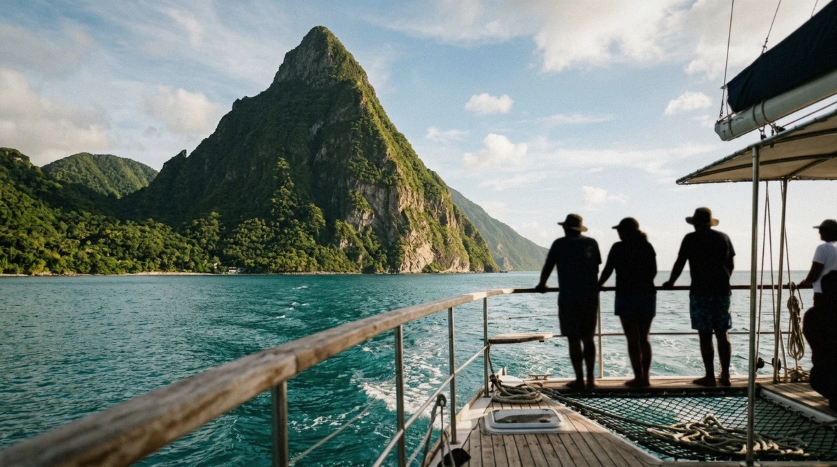
The standard way a cruise day meets the peaks: from the deck, close enough to read the rock strata. Editorial illustration generated for this guide.
Climbing Them: One Peak for Hikers, One for Mountaineers
Gros Piton runs an official, managed trail: 771 metres of stair-steep jungle route, a mandatory certified guide assigned at the gate, a US$50 entrance fee that includes the guide, and a honest four-hour round trip with a summit view over both coasts. It is demanding but public - the details, the pacing and the port-day arithmetic live in the Gros Piton hike guide.
Petit Piton is the sharper, closer, more photogenic peak, and the reason it appears in no tour brochure's itinerary is simple: there is no maintained trail. The line up its flank is a steep, eroded scramble through dry forest with real exposure and route-finding - a mountaineering route, not a hike, with climbing experience the standard prerequisite and guides arranged privately through Soufriere. It has been climbed by plenty of fit adventurers and it has turned back plenty more; the park system does not run it, and port-day plans should admire it from the water, where it photographs best anyway.
The pair even divide the swimming: the reefs at their feet - Sugar Beach's house reef, the Anse Cochon gardens north of them - are the finest snorkelling on the tours, and coral claims nearly 60% coverage in the bay's protected zones.
The Pitons on a Cruise Port Day
Geography sets the rule: the peaks sit roughly 35 winding kilometres from the cruise piers - about 90 minutes by road each way - but a short, spectacular sail down the coast. That arithmetic is why the sea routes dominate the tour lists: a catamaran day sail trades the drive for a morning under canvas and reaches Soufriere Bay by late morning; a speedboat covers the same coast in half the time and holds the beach stop longest; a land tour takes the road and adds the volcano and waterfall stops the boats cannot reach.
Every route through the homepage comparison is built around the same sightline - the peaks over the boat's bow, or the pull-in above Soufriere - and the choice among them is about what sits between the photo stops: mud and waterfall (land), swim and snorkel (boat), or the mountain itself (the hike, for the fit and the long-call).
One naming note that saves confusion in port: half the island's products carry the word Piton - Piton beer, Piton playlists, the Piton cruisers - and the beer is worth the try. The peaks themselves need no booking; the angle you want them from does.
The last word belongs to the timing: the peaks reward whichever end of the day you give them. The morning tours catch the bay before the trade-wind haze builds; the late-afternoon sail home catches the light that made the peaks famous. Every listing on the comparison runs one of those two windows - the only wrong choice is no window at all.
Piton: The Other Famous Name
The peaks lent their name to the island's lager - Piton, the blonde, lightly hopped beer brewed by Saint Lucia's own brewery and sold everywhere the cruise crowd walks, from terminal bars to beach shacks. It is the standard order at Reduit's beach bars, the included-can on many boat tours, and the souvenir that travels worse than it drinks. The brewery also cans a shandy and a cider under the same roof; none of it is craft, all of it is cold, and on a deck with Petit Piton rising off the bow it tastes exactly like the marketing says.
The name-check is the island's favourite bit of self-branding - do not leave without understanding the joke: on this island, 'a Piton with a Piton' is a complete sentence.
Reading the Rock: A Longer Geology Note
The Pitons are the visible endpoints of a story that starts kilometres down. The Caribbean's island chain runs on a subduction zone - the Atlantic's sea floor sliding beneath the Caribbean plate - and every island in the chain is a volcano in some stage of the same lifecycle. Saint Lucia's chapter: a large volcanic centre built here over millions of years, whose youngest and most resistant vents are the two domes the sea has not erased.
Gros Piton reads older and worn: a broad-sided dome whose flanks have slumped into the steep-but-vegetated slopes the trail climbs, its summit a grassy platform where the forest gives up. Petit Piton is the sharper text in the story - a younger, harder plug whose near-vertical sea walls show the rock's columnar jointing where the cooling magma cracked into pillars, the same geometry as Giant's Causeway scaled to a sea cliff.
Between them, the geology explains the tourism: the collapsed caldera inland holds the Sulphur Springs field whose boiling springs and mud pots are the system's living plumbing; the beaches at their feet - Sugar Beach between the peaks, Anse Cochon up the coast - are sand manufactured from exactly this eroding rock; and the reef that makes the snorkelling runs on the hard platforms the volcanics left underwater. A port day that takes the mud bath and the boat past Petit has, geologically speaking, visited the same single volcano twice.
Photographing the Pitons: The Light and the Angles
The peaks are photogenic all day and flattering twice. Morning belongs to the boat decks and the Soufriere waterfront: the sun rises behind the interior, so the peaks' sea-facing walls sit in soft shade with the light raking across from the east - the sailing tours that reach the bay before ten get the peaks in their gentlest contrast, the ridgelines readable rather than silhouetted.
Late afternoon reverses the money shot: from the north - the viewpoints above the Soufriere road, the Marigot Bay lookout's pull-ins - the peaks face the setting light and burn amber, which is the hour every resort brochure was shot in. Cruise days rarely hold that light; the westbound sail home on a catamaran tour catches its opening act around three.
The technique notes: polarising filter or the phone's equivalents - the Caribbean haze and the sea glare are the real enemy, not the light; expose for the peaks, not the sea (the water fools every meter into underexposing the rock); and the wide shot wants a foreground - the fishing boat, the palm, the jetty - because the peaks alone have been photographed a billion times and the foreground is the only novelty left.
And the honesty note: the classic Sugar Beach composition - white sand curving between both peaks - needs the beach-level angle the speedboat and catamaran stops deliver; from the water's surface, the towers read their full height. No other angle on the island says it as completely.
The Management Area: Fees, Rules and Where the Money Goes
The Pitons Management Area is not a park in the postcard sense - it is a working conservation landscape, and the visitor-facing rules are its operating budget walking around in uniform. The US$50 Gros Piton trail fee funds the guide system, the trail's maintenance on eroding volcanic soil, and the forestry presence that keeps the route from loving itself to death; the marine sections - the reef platforms the snorkel tours use - sit under the same management's mooring-buoy program, which is why the boats tie to buoys rather than anchors.
The rules a visitor actually meets: no independent climbing on either peak (Gros with the assigned guide only; Petit's route effectively closed to casual attempts), no anchoring on coral inside the bay, no removing anything - the shells, the plants, the black sand all belong to the system - and the drone rules that national parks everywhere enforce and the park here actually checks.
Where the money lands, briefly: the MAA's community structure routes a share of the fees and the concession licences to the Soufriere villages that surround it - the guides at the Gros gate are largely local men trained through the program, and the mooring and patrol jobs the reef supports stay on the island. The honest traveller's summary: the fees this site's comparison table itemises are not tourist taxes; they are the reason the photograph still exists in its postcard condition.
Eating in Piton Country
The peaks' shadow holds the island's best eating, and a port day that plans lunch well has doubled the tour. In Soufriere town, the waterfront and back streets run the honest Creole counters - stewed chicken, fish broth, callaloo, the day's catch with the island's green seasoning - at prices the resort strip would double; the market square's bakeries handle the breakfast end. On the estates, Morne Coubaril and its neighbours serve the plantation lunch the Land and Sea format often includes - buffet Creole under the trees, cocoa and rum demonstrations after.
At Sugar Beach, eating is resort-priced with the view in the bill - the beach bar serves honestly for what it is, and the speedboat tours that hold the bay long enough let the cooler be the lunch plan instead.
And the drinks shelf: Piton lager needs no introduction beyond this page's, but the estate rums - Chairman's Reserve and Bounty, distilled up the coast in the north - are the tasting the villages pour at the plantation stops, and the cocoa tea the estates brew from their own beans is the breakfast the island has been drinking since chocolate was money here. The port day's rule holds at every price point: eat where the coaches eat only if the coach booked the table.
The Pitons: Questions
Why are the Pitons in Saint Lucia famous?
Because nothing else in the Caribbean looks like them: two steep volcanic plugs - 771 m and 743 m - rising directly from the sea in the same bay, framing beaches and boat routes in a silhouette that has become the island's entire visual identity. They anchor the Pitons Management Area, a UNESCO World Heritage Site since 2004.
How were the Pitons formed?
As erosion, not eruption: the Pitons are hardened volcanic vents - solidified magma domes - left standing after the softer surrounding rock washed away. The caldera of the system that created them lies inland, where the Sulphur Springs geothermal field still runs at boiling point.
Can you climb the Pitons?
Gros Piton, yes: a managed trail with a mandatory certified guide included in the US$50 park fee, four hours round trip and a both-coasts summit view. Petit Piton has no public trail - its route is an exposed scramble for experienced climbers with private guides, and port-day visitors meet it from the water instead.
Where is the best view of the Pitons?
The classic bow-on shot comes from a west-coast tour boat; the postcard itself is Sugar Beach between the peaks; the high angle is from the highway pull-ins above Soufriere; and the money view - Petit at eye level, both coasts below - is the summit of Gros Piton. Each costs a different slice of a port day.
How far are the Pitons from the cruise port?
About 35 km south-west of Castries - roughly 90 minutes by the winding road each way, or a short dramatic sail down the coast. That arithmetic is why the catamarans and speedboats dominate the shore-excursion lists: they trade the drive for deck time and reach the peaks' bay by late morning.
Is there snorkelling by the Pitons?
Yes - the sheltered bay around the peaks holds some of the island's best reefs, with coral covering close to 60% of the Pitons Management Area's marine zones. The boat tours build a snorkel stop here, most often off Sugar Beach or Anse Cochon, where the reef starts within swimming distance of shore.
Can you swim at the Pitons?
Yes - the bay at their feet holds some of the island's best swimming: Sugar Beach's calm, clear water between the peaks, with the reef starting within swimming distance of shore. On a port day the swimming arrives by boat - the catamaran and speedboat tours hold a swim stop in the bay - while the land route burns four hours of road for the same water.